Cyclone Watch November 2026: IMD Rain Alerts for Andhra Pradesh, Odisha and Tamil Nadu
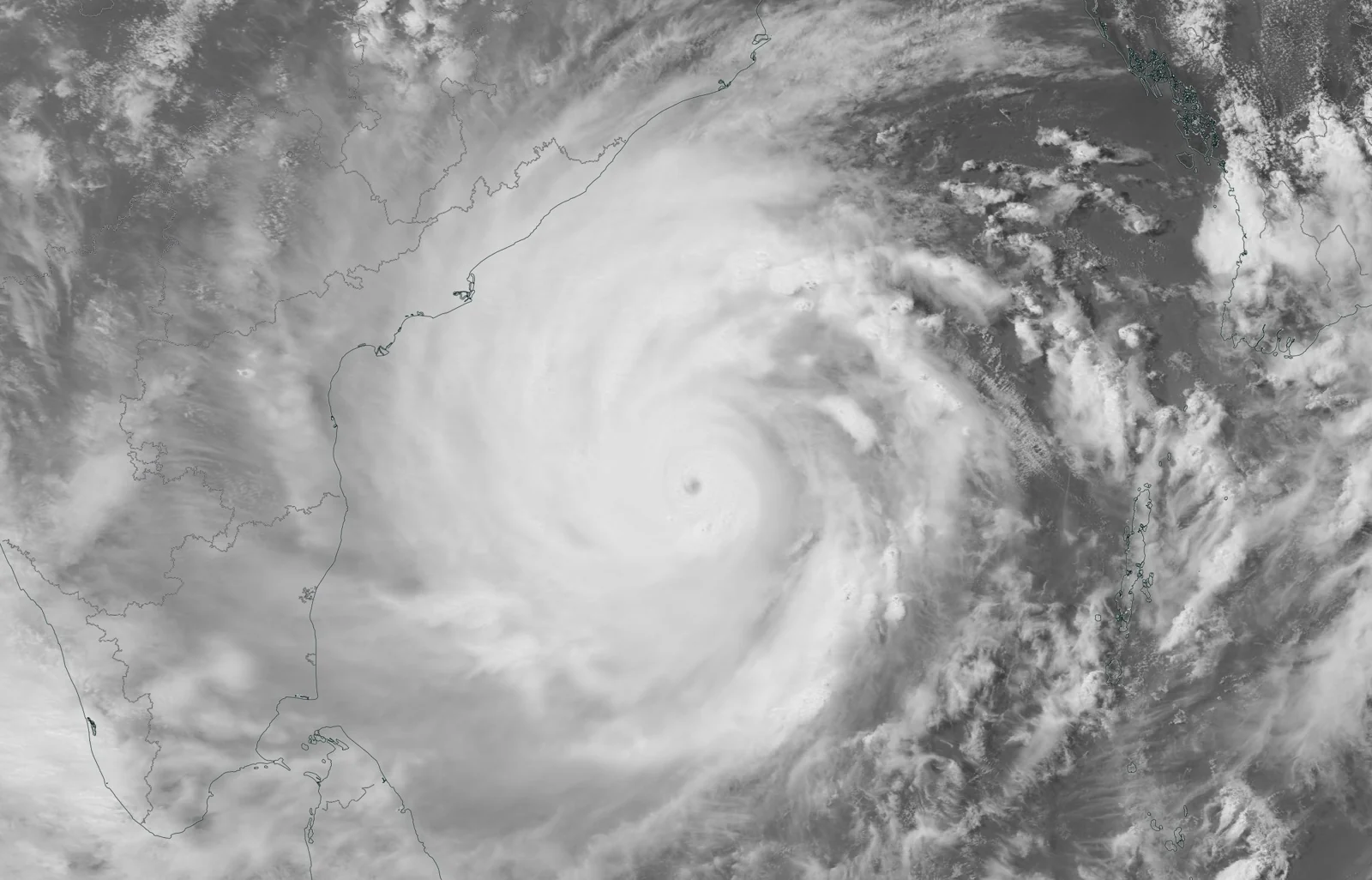
A deep depression over the Bay of Bengal is forecast to strengthen, with Andhra Pradesh and adjoining south Odisha under a pre-cyclone watch. Following our earlier weather update, this report separates the storm’s current stage from rainfall forecasts for later dates.
Representative archive satellite image: Cyclone Amphan, 18 May 2020; NOT the November 2026 weather system. Photo: NASA / Wikimedia Commons, public domain. Source: commons.wikimedia.org/wiki/File:Amphan_2020-05-18_1746Z.jpg. Resized and converted to WebP.
Current status: deep depression, with strengthening forecast
IMD’s early-hours coastal bulletin on 16 November identified a deep depression over the southeast and adjoining southwest Bay of Bengal. It forecast a cyclonic storm by the evening of 16 November and a severe cyclonic storm by the evening of 17 November.
Those later stages are forecasts in the bulletin used here. This report does not claim that the system has already reached them, assign an unconfirmed cyclone name or announce a settled landfall location.
State and regional rainfall outlook
| Area | Dated forecast information |
|---|---|
| Coastal Andhra Pradesh | 16 November issue: heavy rain on 18 November; extremely heavy rain on 19–20 November |
| Odisha | 16 November issue: heavy rain on 18 November; very heavy rain from 19 November |
| Tamil Nadu, Puducherry and Karaikal | 15 November district-warning maps show selected northeastern districts under warnings during 17–20 November; intensity and coverage vary |
The Andhra and Odisha subdivision pages list no warning for 16–17 November. This distinction is important: a developing cyclone and a warning for a later date do not mean the same rainfall intensity is expected everywhere today.
What the Andhra coastal bulletin says
The Visakhapatnam bulletin issued at 3:43 AM IST on 16 November described scattered rain or thundershowers, squally weather and moderate-to-rough seas along the Andhra coast. Its validity extended to 2:30 PM IST on 16 November.
How to read an alert without misunderstanding it
Look for the issue time, the valid dates and the named district or subdivision. A state-level headline is a starting point; local instructions are what determine changes to a particular journey, fishing activity or outdoor plan.
A satellite photograph from an earlier cyclone is not evidence of the current system’s size or track. The featured image is therefore explicitly labelled as an archive image of Amphan from 2020.
Practical planning for the coming days
Check the latest IMD district warnings and local administration notices before travelling to coastal areas. Follow harbour and fisheries instructions, avoid flooded roads, and keep essential travel plans flexible where warnings apply.
Forecasts can change as new observations arrive. This article is a dated morning summary for 16 November, not a live storm-tracking service or a guarantee of conditions at every location.
A household preparation checklist
Official disaster-preparedness guidance recommends having essential supplies ready and knowing the safest route to a suitable shelter or higher ground if local authorities call for movement. Make the plan before weather conditions deteriorate, particularly where a household includes someone who needs help travelling.
Keep a torch, charged communication devices, necessary medicines and important documents accessible. Think about how family members will contact each other if they are in different places. A written plan is useful when a phone battery is low or a familiar route becomes unavailable.
These are general preparedness steps, not an instruction that every household in the three states must evacuate. The relevant trigger is the warning and direction issued for the actual location. Follow an evacuation instruction promptly rather than waiting to judge the strength of a storm from a photograph or a brief lull in the wind.
Travel and flooded roads
The Ministry of Home Affairs’ disaster guidance advises against driving through flooded areas. A road surface, sudden drop or water current may be difficult to see, so a familiar road cannot be assumed to be safe merely because it was usable earlier.
If a trip is optional, compare its timing with the dates of the local warning. If travel is necessary, check official transport updates and identify alternatives before leaving. A forecast for a later day can still be relevant to a return journey even when the outward journey begins in dry conditions.
Why a quiet interval can be misleading
NDMA’s SACHET guidance cautions that a drop in wind does not necessarily mean a cyclone has ended. Decisions about leaving shelter or returning to exposed areas should follow official instructions, rather than a short period of apparently calmer weather.
Likewise, a distant-cautionary port signal, a district rainfall warning and a forecast cyclone track describe different parts of the situation. They should not be collapsed into one claim that every coastal town faces identical conditions at the same hour.
Share warnings with their context
When passing an alert to family or colleagues, include its issuing authority, location, issue time and valid dates. Avoid sharing an old satellite image without its caption. Accurate context helps people act on the warning that applies to them rather than on a more dramatic but unrelated image.
Reporting sources: IMD National Bulletin No. 5 dated 16 November, 0230 IST; CWC Visakhapatnam bulletin, 0343 IST; IMD Andhra Pradesh and Odisha subdivision warnings dated 16 November; district maps in IMD’s 15 November release; NDMA SACHET and Ministry of Home Affairs cyclone/flood preparedness guidance.


Post Comment